North York Moors WalksWalking Routes & Hiking Trails
Find North York Moors walks from the list below which features the best walking routes in the area. Most of routes are circular walks although there are a few linear hikes. The walks are listed from the shortest and easiest to the longest more challenging routes. The walks are divided into sub areas so you can find specific walks.
The Great North York Moors walks listed below cater for walkers of all abilities. All walks are free to download and print and all routes have GPX files. The walks cover most areas within the North York Moors National Park and range from easy circular walks to hard moorland walks. Routes following the coast are also popular some using sections of the Cleveland Way.
Area walks and walking guides
Useful guides to walks and walking from these popular centres. Includes places to stay, local amenities and the best walking routes.
North York Moors West Walks
Walking Highlights. The western part of the North York Moors National Park contains some excellent walking. Predominantly moorland, the area is dissected by many valleys or dales. Generally the area is sparsely populated with few facilities in the hamlets and villages. Excellent North York Moors walks include those to Roseberry Topping, Captain Cook's Monument and Highcliff Nab. The Clevland Way crosses this area and provides a useful route for shorter circular walks. Other highlights include walks that include Rievaulx Abbey and routes in Rosedale.
Where to stay - Pickering, Thirsk, Helmsley, Great Ayton and Hutton-le-hole all provide convenient access for walking in this area.
| Walk | Description | Grade | Miles |
|---|---|---|---|
| 2930★ | Roseberry Topping from Newton under Roseberry | easy | 3.20 |
| 3581★ | Gormire Lake from Sutton Bank National Park Centre | easy/mod | 3.40 |
| 1893★ | Ainthorpe Rigg & Little Fryup Dale from Danby | easy/mod | 5.60 |
| 3718★ | Scarth Wood Moor from Osmotherley | easy/mod | 6.00 |
| 3418★ | Cringle Moor & the Wain Stones | easy/mod | 6.00 |
| 3160★ | Roseberry Topping and Captain Cook's Monument | easy/mod | 6.25 |
| 1330★ | Roseberry Topping & Captain Cook's Monument | easy/mod | 6.50 |
| 1921★ | Spaunton Moor from Chimney Bank | easy/mod | 8.10 |
| 3737★ | Commondale & Esk Valley from Danby | easy/mod | 8.20 |
| 1450★ | Little & Great Fryup Dales from Duck Bridge | moderate | 8.25 |
| 1622★ | Hawnby, Bilsdale West and Wetherhouse Moors | moderate | 8.30 |
| 1538★ | Baysdale Circular | moderate | 9.45 |
| 1473★ | Hollin Hill to Square Corner by the Cleveland Way | moderate | 9.45 |
| 2702★ | Ampleforth, Shallow Dale, Yearsley Moor & Wilderness | moderate | 9.50 |
| 1920★ | Rievaulx Moor from Cowhouse Bank | moderate | 9.50 |
| 1525★ | Beck Dale & Rievaulx from Helmsley | moderate | 9.75 |
| 1544★ | Chop Gate, Round Hill & Stumps Cross | moderate | 10.10 |
| 1542★ | The Rudland Ridge from Ousegill Bridge | moderate | 10.10 |
| 1469★ | Carlton Bank, Scugdale, Raisdale & Kirby Bank | moderate | 10.50 |
| 1050★ | Highcliff Nab & Roseberry Topping from Slapewath | moderate | 10.50 |
| 3398★ | Rollgate Bank & Aumery Park from Fadmoor | moderate | 11.00 |
| 3187★ | Esklets and Rosedale Head from Westerdale | moderate | 11.00 |
| 1674★ | Rosedale Valley circular from Little Blakey | moderate | 11.00 |
| 2685★ | Highcliff Nab and Guisborough Moor from Commondale | moderate | 11.10 |
| 1527★ | Farndale Circular from Little Blakey | moderate | 12.00 |
| 2029★ | Lastingham & Rosedale from Hutton-le-Hole | moderate | 12.00 |
| 1524★ | Cold Kirby, Rievaulx Bridge & Wass | moderate | 12.50 |
| 1498★ | Kilburn White Horse, Cold Kirby, Murton, & Sutton Bank | moderate | 14.00 |
| 1497★ | High Paradise around Arden Great Moor from Square Corner | moderate | 14.25 |
| 1468★ | Wain Stones, Bank Foot & Bloworth Crossing from Clay Bank | moderate | 14.25 |
| 3165★ | Roseberry Topping & Highcliff Nab from Eston | moderate | 14.25 |
| 1467★ | Cleveland Way - Roseberry Common to Tidy Brown Hill | moderate | 15.00 |
| 2566★ | Rievaulx Abbey from Kilburn, near Thirsk | mod/hard | 15.00 |
North York Moors East & Coast Walks
Walking Highlights. The eastern part of the North York Moors National Park contains some excellent walking. Predominantly moorland with a rugged coastline, this part of the National Park features many dales that dissect the higher moors. Excellent North York Moors walks include coastal walking following the Cleveland Way especially around Robin Hood's Bay, the Hole of Horcum, and walks from Goathland. The Clevland Way follows the coast in this area and provides a useful basis for shorter circular walks.
Where to stay - Robin Hood's Bay, Whitby, Goathland and Pickering are convenient bases for walking in this area.
| Walk | Description | Grade | Miles |
|---|---|---|---|
| 3533★☩ | Mallyan Spout and Beck Hole from Goathland | easy | 3.00 |
| 3532★ | Runswick Bay to Staithes | easy | 3.80 |
| 3337★ | Dundale Pond from Levisham | easy | 4.80 |
| 3534★☩ | Dundale Pond & Hole of Horcum from Saltergate | easy/mod | 5.20 |
| 3585★☩ | Skelton Tower & Hole of Horcum from Levisham | easy/mod | 7.40 |
| 1012★ | Glaisdale, Great Fryup Dale and Eskdale from Lealholm | moderate | 7.50 |
| 2262★ | Goathland & Grosmont | easy/mod | 7.70 |
| 1464★ | Sleights Moor from Blue Moor | easy/mod | 7.75 |
| 1395★ | Broxa & Broxa Forest | easy/mod | 8.25 |
| 1397★ | Hole of Horcum from Levisham Station | easy/mod | 8.50 |
| 3471★ | Robin Hood's Bay from Ravenscar | moderate | 8.50 |
| 1744★ | Hayburn Wyke & Ravenscar along the Cleveland Way | moderate | 8.50 |
| 1743★ | Sneaton Thorpe & Littlebeck from May Beck | moderate | 8.90 |
| 1887★ | Runswick Bay & Kettleness | moderate | 9.00 |
| 2091★ | Kettleness and Mickleby from Lythe | moderate | 9.70 |
| 1452★ | Leaholm Moor & Scaling Dam | moderate | 9.75 |
| 1867★ | Hole of Horcum & Bridestones from Lockton | moderate | 9.80 |
| 1623★ | Burn Howe Rigg from Jugger Howes | moderate | 10.00 |
| 2130★ | Robin Hood's Bay & Hawkser from Fylingthorpe | moderate | 10.00 |
| 2325★ | Troutsdale Circular | moderate | 10.10 |
| 1564★ | Hayburn Wyke from Scalby | moderate | 10.20 |
| 1396★ | Hole of Horcum and Saltergate Brow from Lockton | moderate | 10.25 |
| 1758★ | Newton House Plantation & Stony Leas | moderate | 10.30 |
| 2583★ | Iburndale and the Esk Valley from Stainsacre | moderate | 10.30 |
| 1675★ | The Esk Valley & Egton High Moor | moderate | 10.50 |
| 1922★ | Goathland & Howl Moors | moderate | 11.20 |
| 1930★ | Wheeldale Moor circular | moderate | 11.30 |
| 2090★ | Easington Beck & Staithes from Loftus | moderate | 11.50 |
| 1602★ | Saltergate, Fylingdales & Allerston High Moor | moderate | 11.50 |
| 2077★ | Glaisdale Moor circular | moderate | 11.90 |
| 2665★ | Cawthorne Roman Camp Circular | moderate | 12.20 |
| 1476★ | Boulby Mine to Whitby by the Cleveland Way | moderate | 12.50 |
| 2563★ | Egton Bridge & Grosmont from Goathland | moderate | 12.50 |
★ GPS file ☩ Route profile
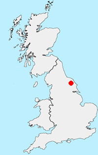
Location Map
North York Moors Guide
Walking in the North York Moors National Park combines dramatic coastal scenery and wild upland moorland with beautiful rural scenery and interesting villages. In addition to these basic ingredients, there are many points of interest from industrial heritage to ruined abbeys and a steam railway. With a well developed network of footpaths and bridle ways this National Park provides a wonderful range of walks.
North York Moors Walking Guide
Other walks in Britain - For a list of all the areas where walks are available go to the Main Walk Index.
Walk grading - Learn how each walk is assessed and select a walk to suit your ability and experience by going to Walk Grading Details.
Messaging & Social Media
Message Walking Britain and follow the latest news.

Mountain Weather
Stay safe on the mountains with detailed weather forecasts - for iOS devices or for Android devices.